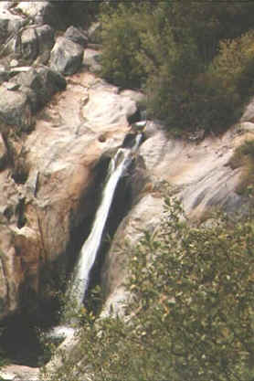
This is a mostly easy ride along the old West Side Rails railroad bed, located in the
Sierra above Sonora. Unlike most of the mountain bike trails in the Sierra, the entire
trail is essentially flat. Thus this is a good ride for those who aren't experienced
technical mountain bikers, or if you're in the mood for a ride without a lot of huffing
and puffing uphill.
HTML - Get the HTML
description for easy online viewing.
PDF  - Get the
Acrobat(R) version--best if you want to print it.
- Get the
Acrobat(R) version--best if you want to print it.
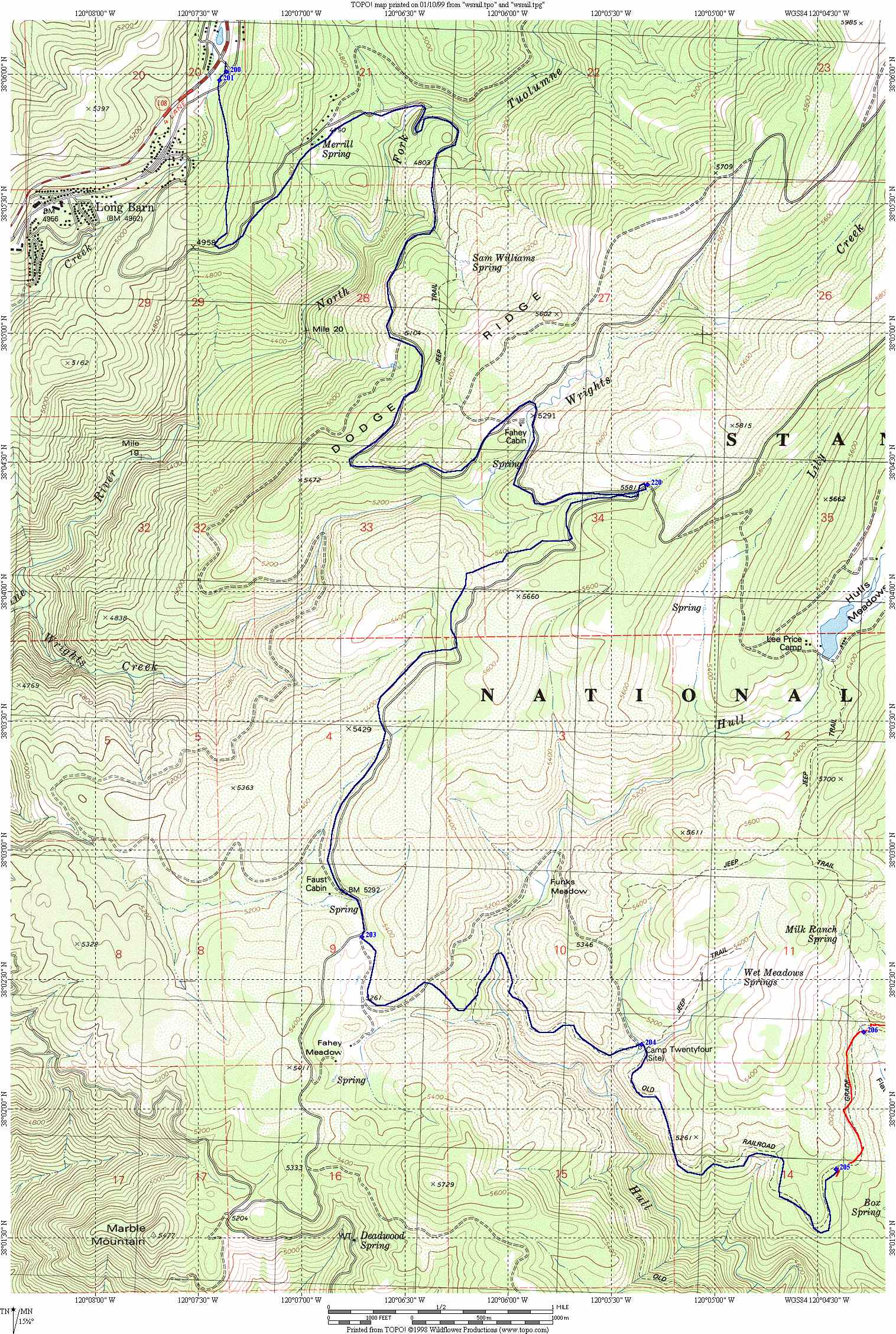
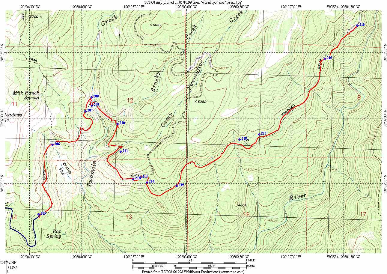
Drive In Map  -
See a TOPO! map of the drive from highway 108 to the
trail head. (Warning: Large file: 615K)
-
See a TOPO! map of the drive from highway 108 to the
trail head. (Warning: Large file: 615K)
Riding Map 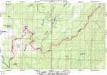 - See a TOPO! map of the ride. (Warning: large
file: 198K)
- See a TOPO! map of the ride. (Warning: large
file: 198K)
TOPO! region and GPS data - If you own TOPO! ("Yosemite, Mammoth, and Central Sierra
Wilderness Areas" CD), you can download the region for this ride and overlay it on
your map. If you own TOPO!GPS, you can also
download the GPS data for the map.
Garmin PCX5 Waypoints and Track log - Download the GPS waypoints
for this ride in a Garmin PXC5 format.
As the name implies, this ride is in Calaveras Big Trees State Park. It is about a 12
mile loop on fire roads through the South Grove of trees. The ride is very pretty as
almost the entire ride is through forest (which also provides a lot of shade--nice during
the summer). If you have the time, there are also hiking trails available which take you
past many of the more spectacular Giant Sequoias in the park.
HTML - Get the HTML
description for easy online viewing.
PDF - Get the
Acrobat(R) version--best if you want to print it.
Map 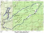 - See a TOPO!
map of the route. (Warning: Large file: 212K)
- See a TOPO!
map of the route. (Warning: Large file: 212K)
Elevation Profile  - See an elevation profile of the route.
TOPO! region and GPS data - If you own TOPO! ("Yosemite, Mammoth, and Central Sierra
Wilderness Areas" CD), you can download the region for this ride and overlay it on
your map. If you own TOPO!GPS, you can also
download the GPS data for the map.
Garmin PCX5 Waypoints and Track log - Download the GPS waypoints for
this ride in a Garmin PXC5 format.